Our Group organises 3000+ Global Conferenceseries Events every year across USA, Europe & Asia with support from 1000 more scientific Societies and Publishes 700+ Open Access Journals which contains over 50000 eminent personalities, reputed scientists as editorial board members.
Open Access Journals gaining more Readers and Citations
700 Journals and 15,000,000 Readers Each Journal is getting 25,000+ Readers
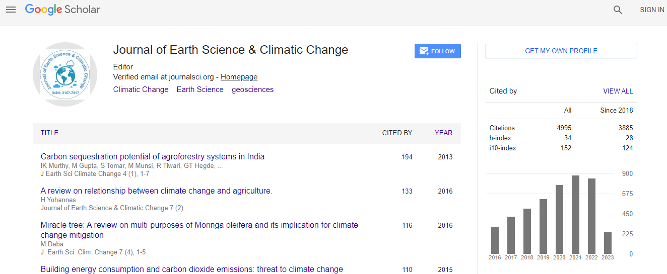
Google Scholar citation report
Citations : 5125
Journal of Earth Science & Climatic Change received 5125 citations as per Google Scholar report
Journal of Earth Science & Climatic Change peer review process verified at publons
Indexed In
- CAS Source Index (CASSI)
- Index Copernicus
- Google Scholar
- Sherpa Romeo
- Online Access to Research in the Environment (OARE)
- Open J Gate
- Genamics JournalSeek
- JournalTOCs
- Ulrich's Periodicals Directory
- Access to Global Online Research in Agriculture (AGORA)
- Centre for Agriculture and Biosciences International (CABI)
- RefSeek
- Hamdard University
- EBSCO A-Z
- OCLC- WorldCat
- Proquest Summons
- SWB online catalog
- Publons
- Euro Pub
- ICMJE
Useful Links
Recommended Journals
Related Subjects
Share This Page
In Association with

Wetlands of the Srinagar city current status and recent trends
5th International Conference on Earth Science & Climate Change
Akhtar Rasool, Mohd Akhter Ali, Syeda Azeem Unnisa, Yasir Abdulqader, Hazim Abdulqader, Ali Ibrahim and Pradeep Kumar
Osmania University, India
Posters & Accepted Abstracts: J Earth Sci Clim Change
Abstract
Wetlands occur in every biodiversity regions and due to regional differences in climacteric conditions; they exist in a variety of types. Although more abundant in other areas, wetlands even exist in deserts. Preventing human degradation and maintaining a range of wetlands from small ponds to large lakes is essential for bird conservation, biodiversity values, socio economic values etc. It has been examined that how wetlands various sizes dotted across Kashmir Valley could sustain diverse wildlife conservation and wetlands in their natural state provide a wealth of values to society. Over exploitation due to human activities are threatening fauna and Flora. The protection and effective management of these wetlands requires great strength. The key to their protection lies in appreciating their scientific values and functions, differences within and between different wetlands. There has been an assumption that conserving large wetlands would adequate to protect the majority of wetland associated bird species and aquatic fauna. Human misuse of wetlands in Jammu and Kashmir is illegal and includes draining, filling the wetlands and converting them for other activities. Since vast majority of wetlands in Jammu and Kashmir are tiny and isolated, that could be converted relatively rapidly and require conservation attention. The local communities in Jammu and Kashmir had a strong interest in maintaining the wetlands supporting the local institutions and enforcing existing legal provision could help these water bodies. Conservation and sound management plan is essential to protecting the existing water bodies, and reclaiming and restoring wetlands. Geographic information system methods are the key element for conservation of wetland management programs. By GIS can be used to prevent damage to the valuable resources and habitats of our woodlands, wetlands, and watersheds. Deforestation, loss of biodiversity, human activities, resource depletion due to global climate change, CO2 emissions, logging, forest fires, and other human intolerance activities are threats to the earth├ó┬?┬?s woodlands, wetlands and watersheds. GIS allows users to handle geospatial information to monitor change in targeted areas. Modeling change with GIS permits conservationists to make scientific decisions about protection, conservation policies, and future land-use practices that will be most beneficial for the conservation of forests, biodiversity, wildlife and natural resources.Biography
Email: akhtarrasool01@gmail.com

 Spanish
  Chinese
  Russian
  German
  French
  Japanese
  Portuguese
  Hindi
Hindi 
