Our Group organises 3000+ Global Conferenceseries Events every year across USA, Europe & Asia with support from 1000 more scientific Societies and Publishes 700+ Open Access Journals which contains over 50000 eminent personalities, reputed scientists as editorial board members.

Open Access Journals gaining more Readers and Citations
700 Journals and 15,000,000 Readers Each Journal is getting 25,000+ Readers

This Readership is 10 times more when compared to other Subscription Journals (Source: Google Analytics)
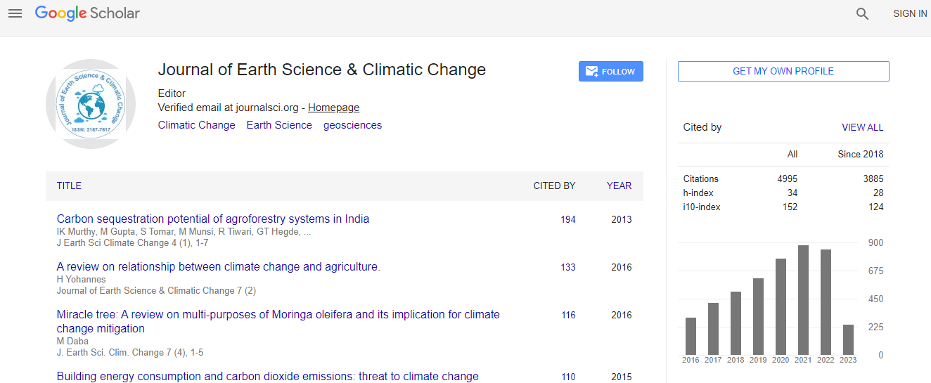
Google Scholar citation report
Citations : 5125

Journal of Earth Science & Climatic Change received 5125 citations as per Google Scholar report

Journal of Earth Science & Climatic Change peer review process verified at publons
Indexed In
  • CAS Source Index (CASSI)
  • Index Copernicus
  • Google Scholar
  • Sherpa Romeo
  • Online Access to Research in the Environment (OARE)
  • Open J Gate
  • Genamics JournalSeek
  • JournalTOCs
  • Ulrich's Periodicals Directory
  • Access to Global Online Research in Agriculture (AGORA)
  • Centre for Agriculture and Biosciences International (CABI)
  • RefSeek
  • Hamdard University
  • EBSCO A-Z
  • OCLC- WorldCat
  • Proquest Summons
  • SWB online catalog
  • Publons
  • Euro Pub
  • ICMJE
Share This Page

New active control algorithm based on uniform deformations

2nd International Conference on Natural Hazards and Disaster Management

Reza Karami Mohammadi and H Ghamari

K. N. Toosi University of Technology, Iran

Posters & Accepted Abstracts: J Earth Sci Clim Change

DOI: 10.4172/2157-7617-C2-043

Abstract
Along the north south (about 150 to 250 km) and east west (800 km) transect, Nepal Himalaya comprises three distinct landscape (High Himalaya, mid-mountain and Siwalik) and are characterized with peculiar features. In this study, the major hazardous elements and underlying causes are examined. The study mainly concentrates to: (1) What are the major hazards causing damages to life and properties; (2) What are the direct and underlying causes; (3) What are major mitigation plans implementing by government, non-government agencies. In mid-mountain, soil erosion (both mass movement and surface erosion) are prominent while in Siwalik landslide and flooding and inundation are prominent (annually 300 people are dying) with annual of about 12.9% of total development expenditure. Similarly, Siwalik area is very young mountain fragile landscape with structurally weak, characterized with massive erosion (900-20000 ton/km 2/yr.), heavy deforestation (1.2 percent/year), unconsolidated geological composition (gravel, sandy, schist, phyllite dominated) and located at high precipitation zone too (2500 to 3500 mm/yr.). There is high drainage density with sudden topographic break in a short range of distance. River bed gradient is frequently changing with distinct avulsion, bed widening (changed from 100 m to 1 km). In addition, mid-mountain region, Rural Road construction is rapid through cutting the unstable hilly slopes. An estimated average of 500 m3/km/yr of debris and up to 2000 m3/km sediment are generated, which is 10 times greater than those expected under natural conditions. In steep slope (>30 degree) farming system is common with low productivity. The above mentioned multi-hazards are directly linked with the livelihood of the people. The government and non-government sectors are joining hands together with structural and non-structural measures. The ecosystem-based disaster risk reduction, soil bioengineering, farming system improvement, adoption of climate change adaptive/mitigative approaches are major efforts.
Biography
Relevant Topics
Top