Our Group organises 3000+ Global Conferenceseries Events every year across USA, Europe & Asia with support from 1000 more scientific Societies and Publishes 700+ Open Access Journals which contains over 50000 eminent personalities, reputed scientists as editorial board members.
Open Access Journals gaining more Readers and Citations
700 Journals and 15,000,000 Readers Each Journal is getting 25,000+ Readers
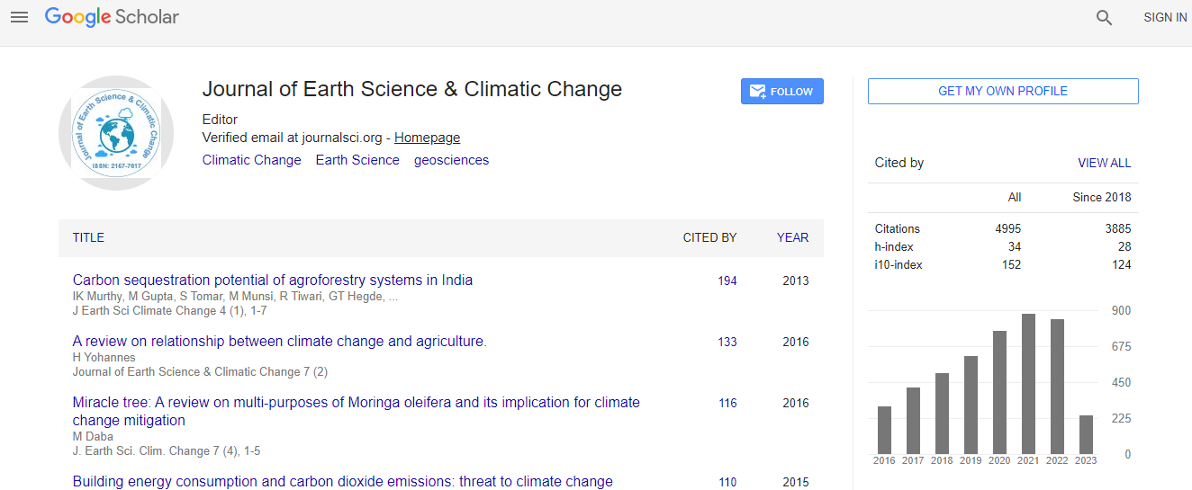
Google Scholar citation report
Citations : 5125
Journal of Earth Science & Climatic Change received 5125 citations as per Google Scholar report
Journal of Earth Science & Climatic Change peer review process verified at publons
Indexed In
- CAS Source Index (CASSI)
- Index Copernicus
- Google Scholar
- Sherpa Romeo
- Online Access to Research in the Environment (OARE)
- Open J Gate
- Genamics JournalSeek
- JournalTOCs
- Ulrich's Periodicals Directory
- Access to Global Online Research in Agriculture (AGORA)
- Centre for Agriculture and Biosciences International (CABI)
- RefSeek
- Hamdard University
- EBSCO A-Z
- OCLC- WorldCat
- Proquest Summons
- SWB online catalog
- Publons
- Euro Pub
- ICMJE
Useful Links
Recommended Journals
Related Subjects
Share This Page
In Association with

Natural emergence of creeks and watercourses in the Rio Quinto basin, Argentina
2nd International Conference on Geology
Adrian H Gallardo, Aldo Giaccardi, David Aguilera and Amancay Martinez
CONICET, Argentina San Luis National University, Argentina
Posters & Accepted Abstracts: J Earth Sci Clim Change
Abstract
The Rio Quinto basin covers approximately 35,000 km2, and constitutes one of the most important water resources for the Midwest of Argentina. Agriculture irrigation and water supply for urban centres is directly dependant on the hydrological processes occurring in the basin. Despite its importance, there are still a number of uncertainties about the system and the mechanisms that trigger gully erosion, and the rapid generation of watercourses in the region. The emergence of surface waters not only alters the hydrological regime, but has catastrophic consequences for property and infrastructure. Observations suggest that the formation of a new drainage system would be controlled by multiple factors such as the topography, geological setting, soil composition, and climate change. In this regard, some watercourses might have exploited older gullies and developed over a pre-existent fluvial system. Additionally, the initiation of a precipitation cycle of particular intensity could be accounted for the increase in erosion rates after 2005. Once gullies develop, the area becomes more susceptible to soil degradation. High sodium and the predominance of fine-grained materials would enhance pipe flow, causing an additional reduction in the soils strength. The hydrological system would not have reached equilibrium yet. Therefore, the stream network is expected to enlarge over time. Results of the study contribute to better define the location of areas vulnerable to soil denudation, and constitute a useful tool for early warning and mitigation of natural disasters in the agricultural regions of Argentina.Biography
Email: adgallardo@geowater.com.au

 Spanish
  Chinese
  Russian
  German
  French
  Japanese
  Portuguese
  Hindi
Hindi 
