Our Group organises 3000+ Global Conferenceseries Events every year across USA, Europe & Asia with support from 1000 more scientific Societies and Publishes 700+ Open Access Journals which contains over 50000 eminent personalities, reputed scientists as editorial board members.

Open Access Journals gaining more Readers and Citations
700 Journals and 15,000,000 Readers Each Journal is getting 25,000+ Readers

This Readership is 10 times more when compared to other Subscription Journals (Source: Google Analytics)
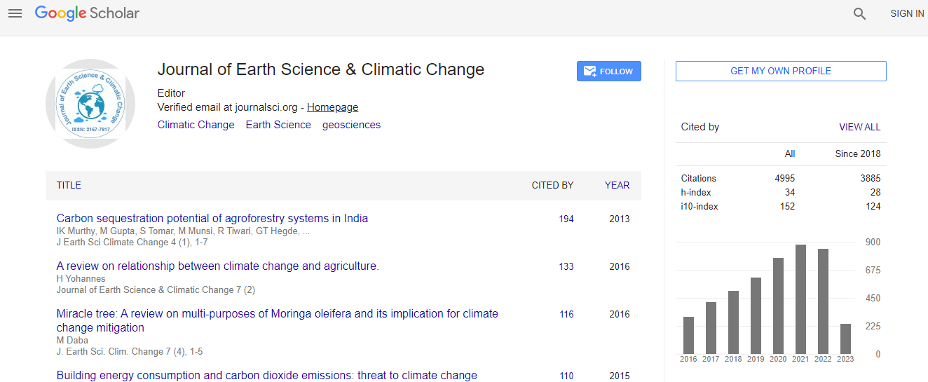
Google Scholar citation report
Citations : 5125

Journal of Earth Science & Climatic Change received 5125 citations as per Google Scholar report

Journal of Earth Science & Climatic Change peer review process verified at publons
Indexed In
  • CAS Source Index (CASSI)
  • Index Copernicus
  • Google Scholar
  • Sherpa Romeo
  • Online Access to Research in the Environment (OARE)
  • Open J Gate
  • Genamics JournalSeek
  • JournalTOCs
  • Ulrich's Periodicals Directory
  • Access to Global Online Research in Agriculture (AGORA)
  • Centre for Agriculture and Biosciences International (CABI)
  • RefSeek
  • Hamdard University
  • EBSCO A-Z
  • OCLC- WorldCat
  • Proquest Summons
  • SWB online catalog
  • Publons
  • Euro Pub
  • ICMJE
Share This Page

Correlating qualitative with quantitative measurement of sea level rise in Florida Bay

3rd International Conference on Earth Science & Climate Change

Douglas J Leaffer

ScientificTracks Abstracts: J Earth Sci Clim Change

DOI: 10.4172/2157-7617.S1.013

Abstract
Four decades of sea level rise have been well documented in Florida Bay. National Oceanic and Atmospheric Administration (NOAA) Tides and Currents gauging station data from the middle Florida Keys show a trend of 2.78 mm sea level rise per year since 1970. These data points can be correlated with qualitative observations from the same region - in this case from a fishing guide with more than 30 years guiding experience in Florida Bay. Observations of the fishing guide include reference to seasonally submerged boat launch ramps and docks in Flamingo, at the extreme southern tip of mainland Florida. Certain docks were noted to have been partially submerged for two weeks in the 1980s, and by late 2012 were fully submerged and inaccessible to boating for nearly two months - the annual high water season occurring in the fall. An analysis of NOAA gauging station data from Vaca Key, FL correlates the fishing guide?s qualitative observations remarkably well. Monthly water elevation data from the Vaca Key station from 1970 to 2013 confirm peak water levels occur annually in October. More concerning are the long term data records confirming the annual fall flooding elevations in the 1980s which are today the average elevations. With a trend of sea level rise equivalent to 0.91 feet in 100 years in this region, the impacts of flooding due to climate change on coastal communities surrounding Florida Bay are measurable in ?real time? environmentally, commercially and economically
Biography
Douglas J Leaffer graduated from the University of Miami, FL with a BS in Geological Sciences, where he studied with renowned paleoclimatology pioneer Dr. Cesare Emiliani. Prior to earning an MS in Civil and Environmental Engineering from Tufts University, MA, he worked as an environmental scientist and hydrogeologist for several leading consulting firms, including Camp Dresser & McKee, EG & G, and Leggette, Brashears and Graham. He began teaching as an adjunct faculty at Merrimack College, MA Civil Engineering Department in 2009 and is currently full-time faculty in the Department of Physics and Earth Science at Framingham State University, MA.
Relevant Topics
Top