Our Group organises 3000+ Global Conferenceseries Events every year across USA, Europe & Asia with support from 1000 more scientific Societies and Publishes 700+ Open Access Journals which contains over 50000 eminent personalities, reputed scientists as editorial board members.

Open Access Journals gaining more Readers and Citations
700 Journals and 15,000,000 Readers Each Journal is getting 25,000+ Readers

This Readership is 10 times more when compared to other Subscription Journals (Source: Google Analytics)
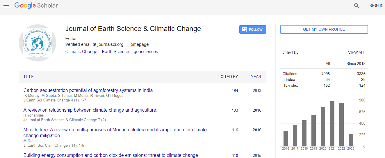
Google Scholar citation report
Citations : 5125

Journal of Earth Science & Climatic Change received 5125 citations as per Google Scholar report

Journal of Earth Science & Climatic Change peer review process verified at publons
Indexed In
  • CAS Source Index (CASSI)
  • Index Copernicus
  • Google Scholar
  • Sherpa Romeo
  • Online Access to Research in the Environment (OARE)
  • Open J Gate
  • Genamics JournalSeek
  • JournalTOCs
  • Ulrich's Periodicals Directory
  • Access to Global Online Research in Agriculture (AGORA)
  • Centre for Agriculture and Biosciences International (CABI)
  • RefSeek
  • Hamdard University
  • EBSCO A-Z
  • OCLC- WorldCat
  • Proquest Summons
  • SWB online catalog
  • Publons
  • Euro Pub
  • ICMJE
Share This Page

Classification methods for inland excess water modeling

2nd International Conference on Earth Science & Climate Change

József Szatmári, Boudewijn van Leeuwen, László Henits, Minucsér Mészáros, Dragoslav Pavić2, Zalán Tobak, Stevan Savić and Dragan Dolinaj

Posters: J Earth Sci Climate Change

DOI: 10.4172/2157-7617.S1.010

Abstract
I nland excess water flooding is a common problem in the Carpathian Basin. Nearly every year large areas are covered by water due to lack of natural run off of superfluous water. This phenomenon where water remains temporary in local depression is called inland excess water. Inland excess water damages crops, obstructs agricultural activities and local transportation, leads to soil and groundwater contamination and deterioration of the soil quality in the long term. In the border region of Hungary and Serbia, the natural circumstances are such that the area is vulnerable to inland excess water. To study the development of this phenomenon it is necessary to determine where these inundations are occurring. This research evaluates different methods to classify inland excess water occurrences on a study area covering south-eastern Hungary and northern Serbia. Three separate methods are used to determine their applicability to the problem. The methods use the same input data set but differ in approach and complexity. The input data set consists of a mosaic of RapidEye medium resolution satellite images. This study uses (semi-) automatic classification methods to determine the occurrences of inland excess water based on satellite images. The results of the classifications show that all three methods can be applied to the problem and provide high quality satellite based inland excess water maps over a large area.
Biography
József Szatmári has completed his Ph.D. in 2006 from University of Szeged and his postgraduate engineering studies from Technical University of Budapest in 2007. He is Assistant Professor of Applied Geoinformatics Laboratory of USZ. He has published more than 15 papers in reputed journals.
Relevant Topics
Top