Our Group organises 3000+ Global Conferenceseries Events every year across USA, Europe & Asia with support from 1000 more scientific Societies and Publishes 700+ Open Access Journals which contains over 50000 eminent personalities, reputed scientists as editorial board members.
Open Access Journals gaining more Readers and Citations
700 Journals and 15,000,000 Readers Each Journal is getting 25,000+ Readers
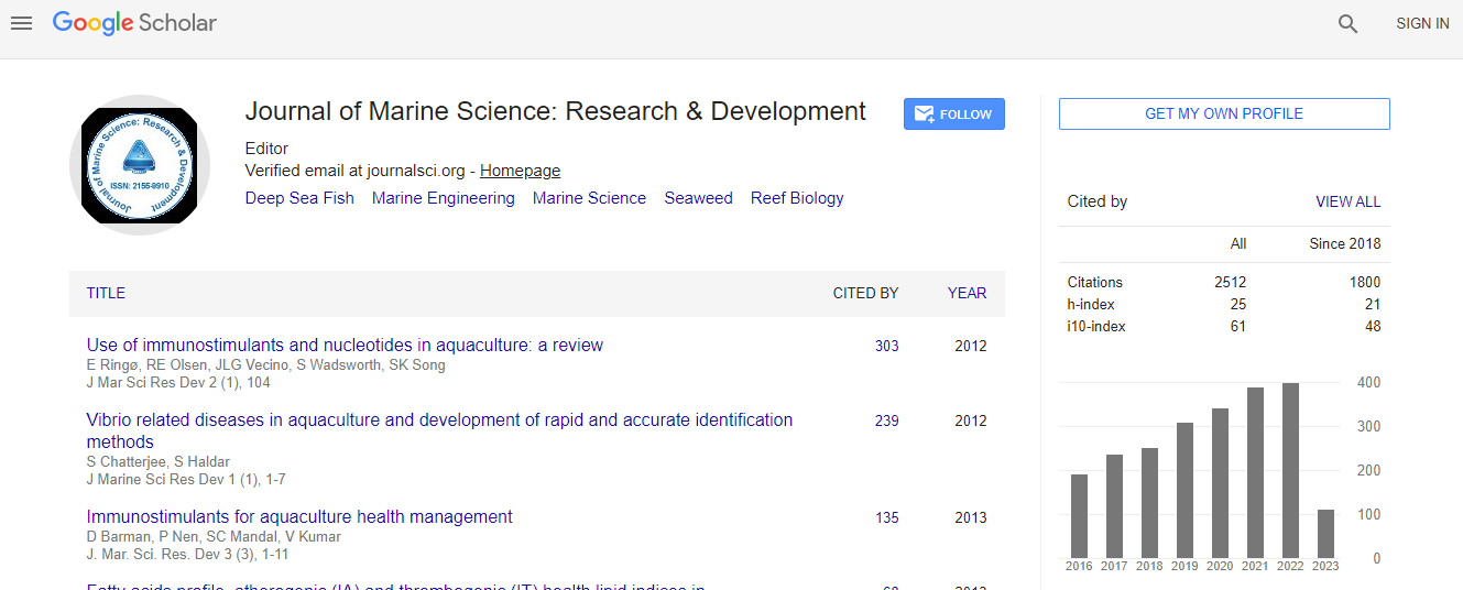
Google Scholar citation report
Citations : 3189
Indexed In
- CAS Source Index (CASSI)
- Index Copernicus
- Google Scholar
- Sherpa Romeo
- Open J Gate
- Genamics JournalSeek
- Academic Keys
- ResearchBible
- Ulrich's Periodicals Directory
- Electronic Journals Library
- RefSeek
- Directory of Research Journal Indexing (DRJI)
- Hamdard University
- EBSCO A-Z
- OCLC- WorldCat
- Scholarsteer
- SWB online catalog
- Virtual Library of Biology (vifabio)
- Publons
Useful Links
Recommended Journals
Related Subjects
Share This Page
Change detection study in Karnataka coast line using multi temporal satellite data-remote sensing and geographic information system approach
4th International Conference on Oceanography & Marine Biology
Rahisha T, K C Gouda and Laxmikantha B P
Karnataka State Remote Sensing Application Centre, India CSIR Fourth Paradigm Institute, India
Posters & Accepted Abstracts: J Marine Sci Res Dev
Abstract
Coast is unique environment in which atmosphere, hydrosphere and lithosphere contact each other. Because of dynamic interaction between ocean and land coastal zone are most vulnerable for land use changes in this rapid industrialization and urbanization epoch. Changes in land use caused due to natural phenomena like waves, tides, currents, winds in addition to anthropogenic activities. In this paper an attempt has been made to study coast line changes in terms of erosion, accretion, inundation due to sea level and storm surge etc by using Remote Sensing and GIS for Karnataka coast. Coast line detection is critical in coastal zone application, shifting of coast line caused by natural or anthropogenic forces such as construction of artificial structure ports and harbor leads to changes in coastal zone and its environment. Karnataka├ó┬?┬?s coast line which is also called Karavali stretches extends over a length of 320 kilometers from Mangalore in Dhakshin kannada district to Karwar in Uttara Kannada district. The time scale on which the coast line of Karnataka coast has been studied from 1984-2014. LANDSAT satellite data which has been acquired from United State Geological Survey (USGS) have been used in this study to maintain the gaps of ten years. Also Digital Elevation Model (DEM) of study area collected from USGS. Change detection was performed through Digital Image Processing (DIP) techniques and classification algorithms. A variety of procedures for change detection based on comparison of multi temporal LANDSAT data have been developed. Accurate detection and monitoring of coast line of Karnataka assumes its importance because of high productivity of its ecosystem, concentration of population, exploitation of natural resources, industrial and port development, discharge of waste effluents and increased tourism activities.Biography
Email: rahisha20@gmail.com

 Spanish
  Chinese
  Russian
  German
  French
  Japanese
  Portuguese
  Hindi
Hindi 