


 26 / 34

Page 60
conferenceseries
.com
Volume 6, Issue 2 (Suppl)
J Aeronaut Aerospace Eng
ISSN: 2168-9792 JAAE, an open access journal
Satellite 2017
May 11-13, 2017
May 11-13, 2017 Barcelona, Spain
3
rd
International Conference and Exhibition on
Satellite & Space Missions
Application of remote sensing in mapping potential gold mineralization in Muteh gold mining area, Iran
Hooshang Asadi Haroni
1,2
, Pooya Asadi-Haroni
1,2
and
Ali Taorabidavan
1
1
Isfahan University of Technology, Iran
2
University of Western Australia, Australia
M
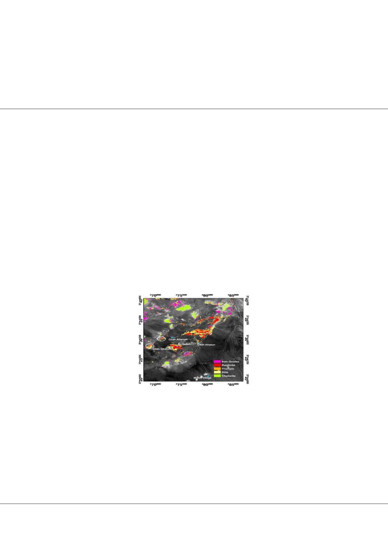
uteh goldmining area is located in 160 kmNWof Isfahan town in the Sanandaj-Sirjanmetamorphic zone of central Tethyan belt
in Iran. Muteh is the oldest active gold mine in Iran. Gold mineralization at Muteh is orogenic type in origin and is associated
with fractured metamorphosed rocks such as metarhyolites showing hydrothermal clay alterations, silicification, carbonatization
as well as iron oxides such as hematite and goethite. Image processing and interpretation were applied on the ASTER satellite
imagery data of about 400 km2 at the Muteh gold mining area to identify important hydrothermal alteration minerals and iron
oxides associated with gold mineralization. After applying preprocessing methods such as radiometric and geometric corrections,
image processing methods such as false colored composite (FCC), principal components analysis (PCA), least square-Fit (Ls-Fit)
and spectral angle mapper (SAM) were applied on the ASTER imagery data to identify hydrothermal alteration minerals and iron
oxides. In this research, reference spectra of important minerals such as chlorite, hematite, goethite, quartz and clay minerals such as
kaolinite, illite, smectite and phengite, identified from laboratory spectral analyses of collected samples of the Muteh gold mining area
measured at Geosense company in the Netherlands, were resampled to ASTER band position, and then used to map several zones
the known and unknown hydrothermal clay alterations, silicification and iron oxides in the Muteh and surrounding Muteh gold
mining areas. This study identified four known gold mineralized areas of Senjedeh, Cheh Khatun, Chah Allameh and Chah Ghorom
in the Muteh gold mining area. In addition, several other important targets showing similar important minerals were identified in the
surrounding Muteh gold mining area. Finally, identified zones of the hydrothermal alteration minerals and iron oxides were validated
by visiting and sampling them in field, and three targets, showing gold and associated arsenic and antimony mineralization, were
suggested for future exploration.
Figure 1:
Processed Aster satellite image of the Muteh gold mining area
Biography
Hooshang Asadi Haroni completed his BSc in Geology; MSc and PhD in Mineral Exploration at ITC and Delft University of Technology, Netherlands. He worked for
three years as Exploration Geologist and GIS Database Analyst at Rio Tinto Mining and Exploration Limited. He is now an Assistant Professor in Mining department
at Isfahan University of Technology in Iran. In addition, he has been appointed as Adjunct Senior Researcher at Centre for Exploration targeting (CET), University
of Western Australia (UWA) since 2013.
hooshang.asadiharoni@uwa.edu.auHooshang Asadi Haroni et al., J Aeronaut Aerospace Eng 2017, 6:2(Suppl)
http://dx.doi.org/10.4172/2168-9792-C1-016