Research Article Open Access
Spatial and Temporal Variation of Heavy Metals Contamination in Recent Sediments from Barigui River Basin, South Brazil
Karina Scurupa Machado1*, Paulo AI Ferreira2, Juliane Rizzi3, Rubens Figueira2and Sandro Froehner41Department of Production Engineering, Federal University of Parana, Curitiba-PR, 81531-980, Brazil
2Oceanographic Institute, University of São Paulo, Oceanographic Square, 191, São Paulo-SP, 05508-120, Brazil
3Department of Hydraulics and Sanitation, Federal University of Parana, Curitiba-PR, 81531-980, Brazil
4Department of Environmental Engineering, Federal University of Parana, Curitiba-PR, 81531-980, Brazil
- *Corresponding Author:
- Karina Scurupa Machado
Department of Production Engineering
Federal University of Parana, Curitiba-PR
81531-980, Brazil
Tel: +55 41 995115715
E-mail: ksmachado@hotmail.com
Received date: November 14, 2016; Accepted date: January 11, 2017; Published date: January 18, 2017
Citation: Machado KS, Al Ferreira PA, Rizzi J, Figueira R, Froehner S (2017) Spatial and Temporal Variation of Heavy Metals Contamination in Recent Sediments from Barigui River Basin, South Brazil. Environ Pollut Climate Change 1:108.
Copyright: © 2017 Machado KS, et al. This is an open-access article distributed under the terms of the Creative Commons Attribution License, which permits unrestricted use, distribution, and reproduction in any medium, provided the original author and source are credited.
Visit for more related articles at Environment Pollution and Climate Change
Abstract
Heavy metals (Cd, Cr, Cu, Pb, Mn and Zn) and artificial radionuclides (137Cs and 210Pb) were investigated in three sediment cores from the Barigui river Basin, South Brazil, in order to reconstruct the spatial and temporal evolution of the pollution by heavy metals. According to the reference standards established by the Canadian quality guidelines, the area presents levels of pollution considered significant. Enrichment factors (EFs) were calculated to estimate the level of contamination in these sediment storages over time. EFs showed a steady increase from bottom to core top throughout the years and this pattern is present in all cores. The magnitude of the EFs suggests that higher contamination is observed in the central and lower parts of the basin, due to regional history and geographic characteristics. The evolution of the contamination by heavy metals is more intense as from the middle of the 19th due to the high demographic, economic and industrial growth in the region. This study clearly contributes to understand when the anthropogenic activities became harmful for the environment in South Brazil, which events were more significant and which parts of the studied area were more affected.
Keywords
Heavy metals; Sediment record; Enrichment factors; Environmental pollution.
Introduction
Chemical pollution of aquatic systems has already become a major public concern in almost all parts of the world. It occurs because of the constant release of pollutants and the intense development of several activities that lead into aquatic systems a large variety of synthetic and geogenic compounds [1,2]. Among the released pollutants, heavy metals are frequently found in environmental samples (sediments, water, organisms and etc.) and its presence is mainly correlated with anthropogenic activities [3].
Heavy metals are commonly found in urban and industrial sewage, coming from geochemical and anthropogenic sources. Soil represents a major sink for heavy metal ions, which may then enter the food chain via plants or leaching into ground water [1]. Also, fertilizers, inks, pharmaceutical and cosmetic products and a large amount of synthetic products contribute to the environmental contamination by heavy metal, as well as their manufacturing processes [3,4]. These hazardous pollutants can enter into the aquatic systems through irregular discharge of urban wastewater, superficial drainage, agricultural activities and atmospheric deposition [5-7].
After to be released and through the processes of chemical adsorption and physical precipitation, metals can remain accumulated in the sediment for a long period [8]. Besides readily accumulate, the sediments also could serve as repository of these and other pollutants in aquatic environments when disturbing events occur [9].
Studies developed to evaluate heavy metals concentrations in the aquatic systems should consider the lithogenic/geogenic origin of these compounds. Lithogenic micro pollutants, as selenium, arsenium, chromium and cobalt, can be found in increased concentrations because the elevation of their content in geological formations or because reactions responsible to transform environmental conditions and consequently change the partitioning behavior on the aquatic system [1,2,10]. Therefore, high heavy metal concentrations might also result from natural processes and the presence of these compounds cannot be only from anthropogenic pollution [5]. These geochemical and background reference values are very important in environmental studies of the pollution and may be used to assess the natural source of trace elements [11].
Metal accumulations in sediments have been frequently investigated in urban rivers. Some elements are commonly found in specific sources, for example, cadmium and chromium are mainly present in domestic sewage [4], lead is mainly linked to traffic activities, cadmium to application of fertilizers, while copper, manganese, mercury and zinc are often associated with street dust samples from different urban and industrial areas [12,13]. The metals such as astatine, vanadium, lead and cobalt were already related to mixed natural and anthropogenic sources. Nevertheless, different parts of the world can present different natural sources due the diversity of soil compositions [12].
The history of the adjacent environment can be reflected in the presence of metals accumulated in sediments from lakes and rivers. Sediment cores can be used to reconstruct the scenario of land use, growing of urban cities and industrial activities, correlating with levels of these chemical pollutants, since remote decades [10,14,15]. The cores are useful for this purpose, once it can present data from up to thousands of years ago [16].
In this study the concentration of heavy metals in recent sediments from three sectors of the Barigui River basin (upper, central and lower) was measured with the following objectives. i) To assess the level of contamination of the area by heavy metals, based on international and reliable reference standards, ii) To analyze the spatial variation of the heavy metals contamination along the basin, iii) To reconstruct the historical evolution of heavy metals contamination and iv) To identify the most significant sources of heavy metals pollution over time.
Materials and Methods
Study area
Barigui River watershed, located in Brazil (25º13’’24’-25º38’’23’S; 49º15’’00’-49º22’’29’W), runs through the city of Curitiba, and it is around its basin that a third of its population live. The road system, local industries and the urban sewage are the main sources of environmental impact of this watershed, especially since the 1950s when there was a rapid and unorganized peak in urban occupation activities [17].
This watershed has a 279 km² drainage basin and can be divided into three sectors with distinct characteristics. The upper sector presents low urbanization, intermediate road system development and some vegetation cover. The central part is dominated by its urban and commercial occupation, while the main industrial conglomerate of the Paraná state and a local landfill site are in the lower sector [18].
Barigui River is 60 km long and cuts through the city of Curitiba with N-S orientation. It is the destination of urban and industrial wastes and that material has riverine sediments as final sink. This region was chosen as a study area of inorganic contamination due to the need for a historic data collection on heavy metals [19].
Sand and silt are the particles size that predominate in the Barigui River basin, with a sedimentation rate relatively constant, over time (0.44 gcm−2.yr−1, ± 0.09) and a drainage pattern predominantly dentritic [17,19].
Sampling and sample treatment
Three sediment cores were sampled in the center of the river, in flat areas of the different watershed sectors: core E-0 in the upper sector, core F-0 in the central sector and core G-0 in the lower sector. Sampling sites are shown in Figure 1. Each core was divided into 2 cm deep subsamples between 0 and 40 cm, 4 cm deep subsamples between 40 and 60 cm and 10 cm deep subsamples between 60 and 80 cm. Those subsamples were frozen and lyophilized.
Analyses
The granulometric distribution of the sediments was assessed through laser diffraction integrated technique in a laser diffraction granulometer (Cilas, model 1064, 0.03-2.36 mm range). For this analysis, the granulometric ranges were separated with standardized sieves to sort out the sand, silt and clay fractions. Then the fine-grained fractions were analyzed in the granulometer. The total carbon content (TOC) was measured using a CHN analyzer (Carlo Erba, model FLASHEA 1112) with the samples treated as described previously.
Radiometric technique involving unsupported 210Pb and 137Cs was used to create an age model of the sediment cores. For this analysis, 10 g of sediment were transferred into air-sealed cylindrical polyethylene containers for gamma counting in a hyperpure low-background gamma spectrometer (EG&G ORTEC, model GMX25190P). The method, previously described by Figueira [20], consists of detector calibration, background radiation detection, efficiency assessment and sample counting for 50,000 s. The determination of age of sediment deposition was performed using the CRS (Constant Rate of Supply) model [21], which considers that unsupported 210Pb is supplied to the sediment at a constant rate through time. The results of 210Pb modeling is then compared to the 137Cs historical peak of the past nuclear fallout maximum of 1963 to evaluate the goodness of the generated age model.
Based on the half-life of 22.2 years of 210Pb, its measurement enables the dating of samples at a theoretical maximum of 178 years (7 halflives) or, in the case of this study, since the 1830s. The interpretation of the results respected this dating maximum; however, the graphic representing the variations in time of the levels of heavy metal also have ages of sediment deposition beyond this limit. This was only done to give a sense of continuity to the generated data that goes past this boundary. Figure 2 presents the vertical profiles of the radionuclides of interest. It can be seen that all cores presented the predicted behaviour for a water body with little recent changes on the local sedimentation rate. This data was used in the age dating based on the CRS model equations from Appleby and Oldfield [21]. Moreover, the pattern of 137Cs indicated the occurrence of a vertical maximum in each core, which can be related to the past nuclear fallout maximum of 1963.
For the heavy metals analysis, approximately 1 g of sediment was treated with an acid digestion technique with HCl and HNO3 [22]. The digested extract was then analyzed in an atomic absorption spectrometer (Perkin Elmer, model 2020FS). Recovery rates were between 85 and 100% for all elements and analytical precision, evaluated with the analysis of 6 homogenized sample replicas, reported a standard deviation lower than 9% for all elements. All analytical blanks and standards were regularly quantified between each 15-samples series.
Data processing
For an unbiased interpretation of heavy metals levels in sediments, the choice of the background values is of utmost importance. Even though many studies use predefined mean values or Earth’s crust mean abundance, the best alternative is the comparison with uncontaminated sediment of similar mineralogy and texture [23]. In this study, the concentration of the core’s bottom most samples was used as background value, which is considered to be previous to the human influence in the region. The evaluation of contamination intensity was assessed with the |enrichment factor (EF) [15], calculated with Equation 1.

Figure 1: Map of Barigui river basin with the current land use, the location of the sampling points and the main pollution sources in the past.

Figure 2:Vertical profiles of 210Pb and 137Cs in the sampled cores. Continuous line=predicted behaviour of unsupported 210Pb; dashed line=moving average of 137Cs. (a) core E-0, (b) core F-0, (c) core G-0.
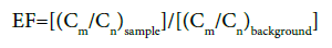
Where (Cm/Cn) sample is the concentration of the element of interest (m) normalized with the reference element (n) in the sample, and (Cm/Cn)background is the concentration of the element of interest (m) normalized with the reference element (n) in the core’s bottom most sample, i.e., the background sample. Based on the radiometric age modelling, this bottom most sample is previous to human influence in the area.
Moreover, to further evaluate the contamination of heavy metals in the Barigui River, the metals concentrations of the three cores were compared to ISQG (interim sediment quality guideline) and PEL (probable effect level) reference values for superficial freshwater sediments [24], to evaluate the contamination of heavy metals in the Barigui River.
The statistical data analysis involved ANOVA to check the existence of statistically significant differences among data variables variance (heavy metals, TOC, granulometry) variance for the cores and Pearson correlation analysis to assess the presence of relationships among the data variables for each sediment profile.
Discussion
Sediment composition
Particle size has a profound influence on the accumulation of heavy metals in sediments. Fine-grained sediments frequently present higher levels of heavy metals due to its higher grain superficial area when compared to the grain volume, in addition to its enrichment in organic matter enrichment and Fe-Mn oxides [25].
Being so, significant vertical granulometric variations can lead to characteristics in the heavy metals distribution that do not represent the real changes on its concentrations. In this study, the granulometric analysis (Table 1 and Figure 3) showed that sand (90-2360 μm) and silt (3-64 μm) are the dominant fractions in all three cores. This dominance can be related to hydrological factors of the region, such as intensity of water currents and water column depth. Heavier particles (such as sand) tend to deposit, whereas lighter ones (such as silt and clay) tend to be transported by the riverine flux [26]. The observed tendency of both silt and clay (<3 μm) distributions are similar and inverse to the sand distribution (Figure 3). All cores presented some level of vertical variation in the granulometric distribution; however, there is no statistically significant difference (p>0.05) in the cores’ particle size composition.
Regarding TOC, cores F-0 and G-0 presented a vertical reduction in TOC content. For core E-0, it was observed a statistically significant (p<0.05) difference in TOC variance, probably due the local characteristics such as the predominance of vegetation cover, which is a natural source of organic matter in the watershed.
The concentrations of the heavy metals presented strong and significant correlation (p<0.05) with all granulometric fractions in cores F-0 and G-0, which can be taken as an indicative of the strong influence of the sediment core composition on the deposition of heavy metals. In core E-0, the absence of such correlations can be related to the other factors, such as a deeper association of the heavy metals with Fe-Mn oxides content, carbonate levels and redox potential [27].
Distribution of heavy metals in recent sediments
The distribution of heavy metals (Figure 4) showed that, before the 1850s the values suffered little variation and can be taken as the regional background. Fluctuations took place from the 1850s and a substantial increment occurred from the 1950s, with several value peaks. This pattern is due to the responses of the watershed to the anthropogenic activities in the region since the 1850s.
The comparison of the concentrations of heavy metals with the Canadian quality guidelines showed that, in all sampled cores, the maximum values of Cd, Cr, Cu, Pb and Zn (Table 1) were above the ISQG threshold and below the PEL values [24], being just Pb in the core E-0 as exception for this statement. This range of values is typical for regions with considerable levels of human pollution. The observed mean values in all three cores are characteristic of recent sediment from urban areas, according the comparison with other literature reports on heavy metals contamination [15,27-29].
As reported in Table 1, there is little variation of the heavy metal content among the cores. The highest values of Cu were observed in core E-0, Pb, Zn in core F-0 and Cd, Cr in core G-0. This distribution can be due to the specific features of each sample site and the geographic distribution of the main pollution sources, discussed below in the text. Those observations are corroborated by the ANOVA performed with the data from Table 2, showing that there is no statistically significant difference (p>0.05) of the heavy metals levels among the cores (the only exception is Cr on core G-0, p<0.05).
Enrichment factors of the heavy metals
The study of sediment vertical profiles can be an important source of information of historic contamination in watersheds. Metals in the environment can be originated from lithogenic sources (natural intemperism of rocks and minerals) or anthropogenic ones (derivative from human activities) [27]. Therefore, the degree of pollution can be estimated from the comparison of the observed levels of heavy metals before human activities and levels above this distinguish the area as anthropogenically affected [30].
However, it is necessary that a differentiation between heavy metals from natural to anthropogenic loads, in other words, the influence of lithogenic-originated metals in the regional deposition of metals, which is observed in the significant correlation with the granulometric fractions (Table 2). The enrichment factor is a tool for such an evaluation, distinguishing the deposition of natural levels of elements to those that are enriched by human activities [31].
| E-0 | F-0 | G-0 | CCME, 2002 | |||||||||||
|---|---|---|---|---|---|---|---|---|---|---|---|---|---|---|
| Mean | Min. | Max. | S.D | Mean | Min. | Max. | S.D. | Mean | Min. | Max. | S.D. | ISQG | PEL | |
| Cd | 1.3 | 0.3 | 2.6 | 0.7 | 1.4 | 0.3 | 2.7 | 0.7 | 1.2 | 0.3 | 3.4 | 0.8 | 0.6 | 3.5 |
| Pb | 21.1 | 7.5 | 58.5 | 11.6 | 31.8 | 7.5 | 68.5 | 18.6 | 24.3 | 6.5 | 49.0 | 12.0 | 35.0 | 35.0 |
| Cu | 29.4 | 6.8 | 77.7 | 17.2 | 28.4 | 7.1 | 61.5 | 18.9 | 20.6 | 1.6 | 58.7 | 12.8 | 35.0 | 197.0 |
| Cr | 28.3 | 7.2 | 69.8 | 15.4 | 39.5 | 8.1 | 75.6 | 24.6 | 69.7 | 10.9 | 204.4 | 48.3 | 37.0 | 90.0 |
| Mn | 133.7 | 48.8 | 228.9 | 52.5 | 103.6 | 42.9 | 207.4 | 39.4 | 97.8 | 62.0 | 167.7 | 26.8 | - | - |
| Zn | 101.4 | 53.3 | 229.0 | 51.0 | 135.0 | 31.8 | 312.4 | 92.0 | 143.0 | 48.1 | 291.6 | 81.9 | 123.0 | 315.0 |
| TOC | 5.4 | 1.9 | 8.2 | 1.2 | 2.6 | 0.6 | 4.3 | 1.3 | 2.6 | 0.3 | 5.1 | 1.5 | - | - |
| Clay | 7.2 | 2.1 | 13.8 | 3.1 | 5.7 | 0.5 | 12.8 | 2.6 | 6.6 | 0.5 | 10.6 | 3.0 | - | - |
| Silt | 29.3 | 11.6 | 59.2 | 12.4 | 31.4 | 2.7 | 55.7 | 14.1 | 37.4 | 2.8 | 61.8 | 16.9 | - | - |
| Sand | 63.6 | 27.0 | 86.1 | 15.4 | 62.9 | 31.5 | 96.9 | 16.3 | 56.0 | 27.6 | 96.7 | 19.8 | - | - |
Table 1: Averages, ranges and standard deviation of the metals concentrations (mg.kg-1), compared with the ISQG (�?nterim Sediment Quality Guideline) e PEL (Probable Effect Level) values from Canadian Quality Guidelines, and percentages of TOC, sand, silt and clay of the sediment cores.

Figure 3:Vertical distribution of particle size and TOC of all sediment cores in percentage.

Figure 4:Vertical distribution of selected heavy metals in the sediment cores in mg.kg-1.
The enrichment factors (EFs) are interpreted according to Sutherland [32], where EF<1 indicate no enrichment, EF between 1 and 2=low contamination, EF between 2 and 5=moderate contamination, EF between 5 and 20=significant contamination, EF between 20 and 40=high contamination and EF>40 indicate extremely high contamination.
Al, Co, Fe and Ti have been consistently used as reference metal in the EF calculation [15,23,27,28]. Still, the choice of the reference metal is not universal and depends in the geological, hydrological and chemical features of the study region [32]. In this study, Mn was chosen as a reference element because: 1) Mn is strongly associated with the fine-grained particles, 2) It has geochemical characteristics similar to many commonly studied trace elements, 3)It has a tendency of uniform distribution in sediments [33]. Liu et al. [34] and Loska et al. [35] reported good results using Mn as a reference metal for EF calculation.
The observation of the vertical variation on the EF (Figure 5) shows a steady increase of the EF from bottom to core top throughout the years, and that this pattern is present in all the cores. Values close to the background were observed until the 1850s (no enrichment). From the 1850s there is EF between 1 and 2 in core E-0 (low contamination) and between 2 and 5 in cores F-0 and G-0 (moderate contamination). From the 1950s a new increment is observed until 2011, EF between 2 and 5 in core E-0 (moderate contamination) and above 5 in cores F-0 and G-0 (significant contamination).
According to the magnitude of the EFs, it can be seen that a sequence of intensity of pollution can be established among the cores, being G-0>F-0>E-0 (Figure 5), the contamination probably being stronger in F-0 and G-0 due to the historic and geographic characteristics of the region, explained in detail below.
Historical changes on the heavy metals pollution
Human activities have magnified the accumulation of heavy metals in water bodies and it became crucial the understanding of this enrichment process, as well as the main sources and deposition drivers. The primarily anthropogenic metals studied here (Cd, Cu, Cr, Pb, Zn) presented three distinct stages or stratigraphic zones of accumulation in sediments [36]. They can be called: chemozone I (before the 1850s) - before the human influence, chemozone II (between the 1850s and the 1950s) - representing the arrival of large immigrant contingents in the region and chemozone III (from the 1950s to the present) - period of great demographic, economic and industrial growth in the study area. The averages, ranges and standard deviation of the metals concentrations (mg.kg-1) per chemozone are presented in the Table 3. Chemozone I represent background values, while chemozone III reflects high levels of anthropogenic activities.
Based on Figure 5, anthropogenic alterations were observed on the heavy metals contents from the 1850s, period of intense immigration, predominantly Polish immigrants, to the area, which tripled the population of Curitiba in less than 20 years [37,38]. Factors such as deforestation, beginning of agricultural activities and use of compounds such as paints and insecticides (rich in heavy metals) [39], contributed to the increase of heavy metals in the environment, given the levels of heavy metals in such human products [40-42].
The agrarian nature of Poland and the shortage of lands explain most those immigrants (90%) being subsistence farmers [43], activity which, together with livestock raising, was their main income source [37,38]. Organic fertilizers were commonly used by those activities due to the lack of synthetic ones and poor soil (mainly sandy) (Figure 3). According to Pereira et al. [42] such fertilizers present high levels of metals (300 mg kg-1 Cu, 500 mg kg-1 Zn, 2 mg kg-1 Cd, 62 mg kg-1 Pb and 17 mg kg-1 Cr) and are subject to being naturally transported to the adjacent water bodies. Evidences also point to the use of insecticides in the region, which was a practice present in the Polish culture of the 19th century, both in agriculture and for the eradication of anthills [41]. Salts such as lead hydrogen arsenate and copper acetoarsenite (Paris green) (representatives of the first generation of pesticides) were used as pesticides [44].
Concentration peaks of Cr and Pb can be observed in cores F-0 and G-0 between 1890 and 1920 (Figures 4 and 5) and can be due to the presence of local tanneries managed by the Municipal Code of Postures (Código Municipal de Posturas) decreed in 1895 [39], whose wastes present high levels of Cd, Cr and Pb [45].
The considerable increase in the reported contamination levels since the 1950s (chemozone III) can be related to the demographic, economic and industrial development of the city. In 1960, the population of Curitiba raised from 180,000 (in 1950) to 350,000 [39], caused by rural immigration from external regions to the urban areas of the city [46]. In 2000, the population goes from 870,000 (in 1970) to 2.7 million, motivated by the economic development of the region [46]. Previous studies have shown that the accumulation of heavy metals in sediments is strongly influenced by urbanization [47].
Therefore, uncontrolled urban growth usually results in decline in sanitation conditions with the increase of urban wastes, which can negatively impact the surrounding environment if release without previous treatment. That given that approximately 150 mg kg-1 Zn and 40 mg kg-1 Cu and Pb can be found in untreated urban wastes [48].
Other important contributors of heavy metals related to urbanization and demographic increase are cars and metallic structures [23]. The main activities that release metals to the environment related to vehicular traffic are: tire and brake wearing (Cd, Cu and Zn) [27], fuel combustion (Pb) [49] and engine fluids leaks (Cu and Cr) [50]. Those vehicular emissions presented a considerable increase in the region from 1960, period of profound economic growth in Brazil, called “the economic miracle”, a sudden rise in the collective purchasing power. In this period, there was a 300% increase in car sales in the country [17,19,51,52], which was a factor in the intensification of the deposition of heavy metals in the sampled cores since 1960.
Besides the automotive sector, the chemical industries in Curitiba also passes through a growth period since 1960, concurrent to the development of the city, and went from 6.5% to 48.8% of the industrial fraction of the region between 1974 and 1980 [51]. In the industrial scenario of the area, the pulp/paper and metallurgical industries stand out [51], and their wastes have high levels of heavy metals [53,54]. Such industries are distributed throughout the whole watershed, but are dominantly based on the central and lower sectors, areas of the cores F-0 e G-0. This explains why those cores have higher levels of metals than core E-0.
For those reasons explained above, the spatial distribution of heavy metals and its variation over the years is directly related to the characteristics of the area of sampling site. The impacts of the local street network and urbanization act over all core sites and are the main sources of anthropogenic contamination for core E-0, and moderately act over in the regions of cores F-0 and G-0.
Industrialization is the main contamination driver for core F-0. As can be seen in Figure 5, there is a contamination peak for all elements of interest between 1960 and 1970. In 1950, the implementation of three landfill sites in the area is another contamination source for the core. Bakis and Tunca [55] reported levels of 422 mg kg-1 Cu, 2,394 mg kg-1 Zn, 120 mg kg-1 Cr and 190 mg kg-1 Pb in landfill leachates.

Figure 5:Enrichment factors of the heavy metals of the sediment cores.
| Cd | Pb | Cu | Cr | Mn | Zn | TOC | Clay | Silt | Sand | |
|---|---|---|---|---|---|---|---|---|---|---|
| Cd | 1 | |||||||||
| Pb | 0.505* | 1 | ||||||||
| Cu | 0.527* | 0.743** | 1 | E-0 | ||||||
| Cr | 0.280 | 0.325 | 0.598** | 1 | ||||||
| Mn | -0.312 | 0.184 | 0.227 | 0.373* | 1 | |||||
| Zn | 0.731** | 0.742** | 0.626** | 0.383* | -0.067 | 1 | ||||
| TOC | -0.235 | -0.259 | -0.009 | 0.040 | 0.153 | -0.327 | 1 | |||
| Clay | -0.034 | 0.371* | 0.217 | 0.034 | 0.018 | 0.289 | -0.501* | 1 | ||
| Silt | -0.042 | 0.41* | 0.290 | 0.096 | 0.013 | 0.301 | n0.449* | 0.976** | 1 | |
| Sand | 0.052 | -0.402* | -0.281 | -0.088 | -0.027 | -0.292 | -0.501* | 0.982** | 0.996** | 1 |
| Cd | Pb | Cu | Cr | Mn | Zn | TOC�? �? | Clay�? �? | Silt | Sand | |
| Cd | 1 | |||||||||
| Pb | 0.830** | 1 | ||||||||
| Cu | 0.843** | 0.779** | 1 | F-0 | ||||||
| Cr | 0.790** | 0.912** | 0.889** | 1 | ||||||
| Mn | 0.742** | 0.912* | 0.738** | 0.539* | 1 | |||||
| Zn | 0.811** | 0.804** | 0.892** | 0.897** | 0.641** | 1 | ||||
| TOC�? �? | 0.463* | 0.444* | 0.356 | 0.348 | 0.249 | 0.421* | 1 | |||
| Clay�? �? | 0.244 | 0.401* | 0.377* | 0.437* | 0.079 | 0.440* | 0.037 | 1 | ||
| Silt | 0.484* | 0.493* | 0.587* | 0.604* | 0.196 | 0.574* | 0.097 | 0.791** | 1 | |
| Sand | -0.491* | -0.516* | -0.587* | -0.605* | -0.224 | -0.597* | -0.134 | 0.836** | 0.985** | 1 |
| Cd | Pb | Cu | Cr | Mn | Zn | TOC�? �? | Clay�? �? | Silt | Sand | |
| Cd | 1 | |||||||||
| Pb | 0.769** | 1 | ||||||||
| Cu | 0.707** | 0.867** | 1 | G-0 | ||||||
| Cr | 0.652* | 0.729** | 0.694** | 1 | ||||||
| Mn | 0.206 | 0.375 | 0.059 | 0.108 | 1 | |||||
| Zn | 0.831** | 0.884** | 0.813** | 0.670** | 0.236 | 1 | ||||
| TOC�? �? | 0.293 | 0.375 | 0.460* | 0.447* | -0.122 | 0.350 | 1 | |||
| Clay�? �? | 0.465* | 0.356* | 0.548* | 0.504* | -0.303 | 0.388* | 0.733** | 1 | ||
| Silt | 0.560* | 0.453* | 0.564* | 0.496* | -0.162 | 0.494* | 0.652* | 0.922** | 1 | |
| Sand | -0.546* | -0.444* | -0.562* | -0.513* | 0.179 | -0.472* | -0.657* | 0.939** | 0.995** | 1 |
* Significant correlation P<0.05
** Significant correlation P<0.01.
Table 2: Pearson correlation coefficients among metals, TOC, sand, silt and clay.
| E-0 | F-0 | G-0 | ||||||||||||
|---|---|---|---|---|---|---|---|---|---|---|---|---|---|---|
| Chemozone I | ||||||||||||||
| Mean | Min. | Max. | S.D | Mean | Min. | Max. | S.D. | Mean | Min. | Max. | S.D. | |||
| Cd | 0.6 | 0.4 | 0.8 | 0.1 | 0.5 | 0.3 | 0.9 | 0.2 | 0.4 | 0.3 | 0.6 | 0.1 | ||
| Pb | 12.2 | 8.9 | 21.2 | 5.1 | 9.6 | 7.5 | 12.1 | 1.8 | 9.7 | 6.5 | 15.7 | 4.1 | ||
| Cu | 11.6 | 6.8 | 25.3 | 7.7 | 9.2 | 7.1 | 10.5 | 1.3 | 7.0 | 6.5 | 7.6 | 0.5 | ||
| Cr | 11.8 | 7.2 | 15.7 | 3.1 | 10.0 | 8.1 | 11.0 | 1.1 | 15.1 | 10.9 | 17.4 | 2.9 | ||
| Mn | 128.9 | 85.4 | 209.2 | 57.8 | 92.0 | 69.6 | 124.4 | 23.1 | 88.1 | 62.4 | 107.0 | 19.7 | ||
| Zn | 61.0 | 53.3 | 68.4 | 6.5 | 54.6 | 42.3 | 66.5 | 11.8 | 57.9 | 48.1 | 78.4 | 14.2 | ||
| Chemozone II | ||||||||||||||
| Cd | 1.3 | 0.3 | 2.5 | 0.7 | 1.2 | 0.7 | 2.1 | 0.4 | 0.7 | 0.3 | 1.5 | 0.4 | ||
| Pb | 16.0 | 7.5 | 24.8 | 5.9 | 26.6 | 12.5 | 68.5 | 16.7 | 20.5 | 10.3 | 49.0 | 10.7 | ||
| Cu | 26.5 | 15.4 | 50.4 | 9.3 | 19.8 | 7.7 | 44.0 | 13.0 | 16.4 | 5.8 | 36.1 | 8.7 | ||
| Cr | 33.0 | 8.1 | 69.8 | 16.3 | 28.3 | 9.4 | 49.2 | 15.2 | 59.8 | 15.6 | 97.1 | 29.6 | ||
| Mn | 162.2 | 97.7 | 228.9 | 41.2 | 112.1 | 42.9 | 207.4 | 55.7 | 98.9 | 62.0 | 167.7 | 34.3 | ||
| Zn | 75.1 | 56.2 | 137.7 | 24.0 | 83.9 | 31.8 | 197.5 | 50.8 | 102.7 | 49.1 | 291.6 | 70.4 | ||
| Chemozone III | ||||||||||||||
| Cd | 1.8 | 0.9 | 2.6 | 0.5 | 2.0 | 1.2 | 2.7 | 0.4 | 2.0 | 1.0 | 3.4 | 0.7 | ||
| Pb | 30.3 | 20.5 | 58.5 | 12.1 | 47.2 | 26.3 | 56.3 | 8.9 | 34.3 | 24.2 | 41.4 | 5.9 | ||
| Cu | 40.3 | 16.6 | 77.7 | 19.0 | 45.8 | 17.8 | 61.5 | 12.8 | 31.5 | 24.4 | 58.7 | 9.7 | ||
| Cr | 31.2 | 13.9 | 52.4 | 13.2 | 64.1 | 45.8 | 75.6 | 9.9 | 104.3 | 62.5 | 204.4 | 47.5 | ||
| Mn | 107.3 | 48.8 | 191.4 | 49.5 | 100.5 | 53.0 | 133.8 | 23.7 | 95.0 | 74.1 | 117.8 | 14.3 | ||
| Zn | 146.0 | 93.4 | 229.0 | 49.0 | 222.5 | 133.4 | 312.4 | 69.5 | 221.0 | 184.1 | 255.0 | 22.2 | ||
Table 3: Averages, ranges and standard deviation of the metals concentrations (mg.kg-1) per chemozone.
The area of core G-0 is the most impacted region by the local industries, as it is in a downstream area and receives part of the urbanization impacts. Another aggravating factor is the occurrence of an oil spill in 2000 [56], which are probably responsible for the peaks in Cd, Cr, Cu and Pb levels in that year (Figures 4 and 5). Levels between 100 and 2,000 mg kg-1 of those elements can be found in unprocessed crude oil [57].
Conclusion
The results of this study reflect the evolution of the anthropogenic impact in the aquatic system of Barigui River in the last centuries. Sediments accumulated during the 19th century were already affected by a moderate heavy metal contamination, mainly in the central and lower sectors of the basin. These data are well correlated with the arrival of large immigrant contingents in the region in the period between the middle of the 19th and the middle of the 20th. This contamination increased drastically in the sediments accumulated during the last decades. It was assigned to the high demographic, economic and industrial growth in the region, in 1950s onward, resulting in the contamination by heavy metals, mainly from vehicular traffic and substantial increase of urban and industrial wastes.
Metal deposition is strongly influenced by the sediment core composition in the central and lower parts of the basin, while in the upper part, which presents low urbanization, the deposition process is led by other factors, such as Fe-Mn oxides content, carbonate levels or redox potential. Background values for the selected metals are also well defined in this study.
According to the enrichment factors the central and lower sectors of the basin are considered moderate to significantly contaminated, while the upper sector is considered low to moderate contaminated. These results corroborate with the classification based on the values established by the Canadian quality guidelines. The temporal and spatial difference in the metals contamination along the basin was assigned to the local characteristics related to the current and historic land use.
Finally, the pattern of results of this study provides a historic perspective that establishes a reference framework very important to determine: 1) when anthropogenic activities began to introduce excessively harmful changes in the Barigui River basin, 2) which events significantly contributed to accelerate this environmental change and 3) which areas of the basin were more affected. Therefore, this study significantly contributes to the decision-making in order to protect the environment affected by the mentioned metal sources pollution in the present and future.
References
- Schwarzenbach R, Escher BI, Fenner K, Hofstettern TB, Johnson CA, et al. (2006) Review: The challenge of micropollutants in aquatic systems. Science 313: 1072-1077.
- Sindern S, Trem�?¶hlen M, Dsikowitzky L, Gronen L, Schwarzbauer J, et al. (2016) Heavy metals in river and coast sediments of the Jakarta Bay region (Indonesia) â�?�? Geogenic versus anthropogenic sources. Marine Poll Bull 110: 624-633.
- Zhao G, Ye S, Yuan H, Ding X, Wang J (2016) Distribution and contamination of heavy metals in surface sediments of the Daya Bay and adjacent shelf, China. Marine Poll Bull 112: 420-426.
- Langston WJ, Popea ND, Jonas PJC, Nikitic C, Field MDR, et al. (2010) Contaminants in fine sediments and their consequences for biota of the Severn Estuary. Mar Pollut Bull 61: 68��?82.
- Hernandez L, Probst A, Probst JL, Ulrich E (2003) Heavy metal distribution in some French forest soils: Evidence for atmospheric contamination. Sci Total Environ 312: 195��?219.
- Zhou S, Yuan Qi, Li W, Lu Y, Zhang Y, et al. (2014) Trace metals in atmospheric fine particles in one industrial urban city: Spatial variations, sources and health implications. J Environ Sci 26: 205��?213.
- Geng J, Wang Y, Luo H (2015) Distribution, sources and fluxes of heavy metals in the Pearl River Delta, South China. Mar Pollut Bull 101: 914��?921.
- Zhang Z, Juying L, Mamat Z, QingFu Y (2016) Sources identification and pollution evaluation of heavy metals in the surface sediments of Bortala River, Northwest China. Ecotoxicol Environ Saf 126: 94-101.
- Aldarondo-Torres JX, Samara F, Mansilla-Rivera I, Aga DS, Rodr�?guez-Sierra CJ (2010) Trace metals, PAHs, and PCBs in sediments from the Jobos Bay area in Puerto Rico. Mar Pollut Bull 60: 1350��?1358.
- Eggleton J, Thomas KV (2004) A review of factors affecting the release and bioavailability of contaminants during sediment disturbance events. Environ Int 30: 973��?980.
- Ferrand E, Eyrolle F, Radakovitch O, Provansal M, Dufour S, et al. (2012) Historical levels of heavy metals and artificial radionuclides reconstructed from overbank sediment records in lower Rho�?�?ne River (South-East France). Geochim Cosmochim Acta 82: 163��?182.
- Lu X, Wang L, Li LY, Lei K, Huanga L, et al. (2014) Multivariate statistical analysis of heavy metals in street dust of Baoji, NW China. J Hazard Mater 173: 744��?749.
- Gao L, Wang Z, Shan J, Chen J, Tang C, et al. (2016) Distribution characteristics and sources of trace metals in sediment cores from a transboundary watercourse: An example from the Shima River, Pearl River Delta. Ecotoxicol Environ Saf 134: 186��?195.
- Palanques A, Sanchez-Cabeza JA, Masque P, Leo L (1998) Historical record of heavy metals in a highly contaminated Mediterranean deposit: The Beso`s prodelta. Mar Chem 61: 209��?217.
- Liu E, Birch GF, Shen J, Yuan H, Zhang E, et al. (2012) Comprehensive evaluation of heavy metal contamination in surface and core sediments of Taihu Lake, the third largest freshwater lake in China. Environ Earth Science 67: 39��?51.
- Lee CL, Qi S, Zhang G, Luo C, Zhao LL,et al. (2008) Seven thousand years of records on the mining and utilization of metals from lake sediments in central China. Environmental Science and Technology 42: 4732��?4738.
- Machado KS, Figueira RCL, C�?´cco LC, Froehner S, Cristov�?£o CVS, et al. (2014) Sedimentary record of PAHs in the Barigui River and its relation to the socioeconomic development of Curitiba, Brazil. Sci Total Environ 482â�?�?483: 42â�?�?52.
- Briski SJ, Goes CT, Jesus FS, Kurta J (2007) Quantitative and qualitative analysis of the Barigui river basin for verification of the hydrological and environmental status., XIII Brazilian Geography Applied Physics Symposium, Natal, Brazil.
- Machado KS, Froehner S, Sanez J, Figueira RCL, Ferreira PAL (2014) Assessment of historical fecal contamination in Curitiba, Brazil, in the last 400 years using fecal sterols. Sci Total Environ 493: 1065-1072.
- Figueira RCL (2000) Inventory of artificial radionuclides in seawater and sediments of the southern coast of Brazil. PhD Thesis, Institute of Nuclear and Energy Research.
- Appleby PG and Oldfield F (1978) The calculation of Lead-210 dates assuming constant rate of supply of unsupported 210Pb to the sediment. Catena 5: 1��?8.
- USEPA/United States Environmental Protection Agency (1996) Method 3050B acid digestion of sediments, sludges and soils.
- Zan F, Huo S, Xi B, Su J, Li X, et al. (2011) A 100 year sedimentary record of heavy metal pollution in a shallow eutrophic lake, Lake Chaohu, China. J Environ Monitoring 13: 2788 -2801.
- Canadian Council of Ministers of the Environment (CCME) (2002) Canadian sediment quality guidelines, Summary table (Update 2012). The Canadian Council of Ministers of the Environment, Winnipeg, Manitoba, Canada.
- Forstner U (1990) Inorganic sediment chemistry and element speciation. In:R. Baudo, J. P. Giesy, and H. Muntau (ed.) Sediments: Chemistry and Toxicity of In-Place Pollutants. Lewis Publishers, Inc., Boston, MA, USA, pp: 61-105.
- Froehner S, Martins RF (2008) Evaluation of the chemical composition of the Barigui river sediments in the metropolitan region of Curitiba. Quimica Nova 31:2020-2026.
- Wang G, Liu J, Tang J (2004) Historical variation of heavy metals with respect to different chemical forms in recent sediments from Xianghai wetlands, Northeast China. Wetlands 24: 608��?619.
- Singh KP, Malik A, Singh S, Singh VK, Murthy RC (2005) Estimation of source of heavy metal contamination in sediments of Gomti River (India) using principal component analysis. Water Air Soil Pollut 166: 321��?341.
- Lin C, Mengchang Z, Yuxiang GW, Yang Z (2008). Distribution and contamination assessment of heavy metals in sediment of the Second Songhua River, China. Environ Monit Assessment 137: 329��?342.
- Forstner U, Wittmann GTW (1979) Metal pollution in the aquatic environment. Springer-Verlag, Berlin, Germany.
- Sutherland RA (2000) Bed sediment-associated trace metals in an urban stream, Oahu, Hawaii. Environ Geology 39: 611��?627.
- Reimann C, Caritat P (2005) Distinguishing between natural and anthropogenic sources for elements in the environment: Regional geochemical surveys versus enrichment factors. Science of the Total Environment 337: 91��?107.
- Singhal RK, Venkatesh M, Wagh DN, Basu H, Chavan T, et al. (2012) Determination of chronological heavy metal deposition and pollution intensity in the bottom sediments of Mumbai Harbor Bay, India using 137Cs as tracer. J Radioanal Nucl Chemistry 292: 863��?869.
- Liu W, Zhao J, Ouyang Z, S�?¶derlund L, Liu G (2005) Impacts of sewage irrigation on heavy metal distribution and contamination in Beijing, China. Environ Int 31: 805â�?�?812.
- Loska K, Cebula J, Pelczar J, Wiechula D, Kwapulinski J (1997) Use of enrichment and contamination factors together with geo-accumulation indexes to evaluate the content of Cd, Cu and Ni in the Rybnik water reservoir in Poland. Water Air Soil Pollut 93: 347��?365.
- Mecray EL, King JW, Appleby PG, Hunt AS (2001) Historical trace metal accumulation in the sediments of an urbanized region of the Lake Champlain watershed, Burlington, Vermont. Water Air Soil Pollut 125: 201��?230.
- Balhana A (1969) The Parana State History. Editora Grafipar, Edi�?§�?£o 1, 1: 184.
- Antoczecen S (2005) The Sociability Issues involving Polish immigrant in Parana State. ANPUH ��? XXIII National History Symposium ��? Londrina, Brazil.
- Hladczuk AM, Barz EL, Sutil MS, Boschilia R (2000) Curitiba ��? From the origins to the twentieth century, Curitiba Cultural Foundation, Cultural Heritage Board - Coordination of the House of Memory and Documentary Collections, Unilivre.
- Weichang J, Tingting Y, Sai M (2012) Heavy metal pollution of soils in the site of a retired paint and ink factory. Energy Procedia 16: 21-26.
- Kulikowski R (2009) Changes and spatial differentiation of Polish agricultural production In: Processes of rural space transformation. Rural Studies. Warsaw, Committee of Rural Areas of Polish Geographical Society, Rural Areas Study Group IGSO PAS.
- Pereira BC, Rodrigues CV, Silva CG, Mour�?£o CR, Abreu RJB (2005) Comparison between the mineral composition of manure and vermicompost originating from water buffaloes and cattle. Livestock Research for Rural Development. 17: 534-546.
- Smola K, Dembicz, A (1996) The Polish presence in Latin America. Polish screenplays in Latin America. CESLA: Latin American Studies Center, Vars�?³via: Universidade de Vars�?³via.
- Repula CM Quinaia SP, Campos BK, Ganzarolli EM, Lopes MC (2012) Accumulation of chromium and lead in bryophytes and pteridophytes in a stream affected by tannery wastewater. Bull Environ Contam Toxicol 88: 84��?88.
- Bittencourt JT (2003) Production profile and spatial dynamics of the Curitiba metropolitan region: A reading from the regional development and changes in the production pattern, Revista Paranaense de Desenvolvimento 105: 101-123.
- Magalh�?£es MV, Cintra APU (2012) Demographic dynamics in the state of Parana: Recent tendencies, perspectives and challenges, Revista Paranaense de Desenvolvimento. Curitiba 122: 263-291.
- Van Metre PC, Mahler BJ (2004) Contaminant trends in reservoir sediment cores as records of influent stream quality. Environ Sci Technol 38: 2978-2986.
- Xue ZJ, Liu SQ, Liu YL, Yan YL (2012) Health risk assessment of heavy metals for edible parts of vegetables grown in sewage-irrigated soils in suburbs of Baoding City, China. Environ Monit Assess 184: 3503��?3513.
- Kim JG, Rejmankova E, Spanglet HJ (2001) Implications of a sediment-chemistry study on subalpine marsh conservation in the Lake Tahoe Basin, USA. Wetlands 21: 379��?394.
- Davis AP, Shokouhian M, Nill S (2001) Loading estimates of lead, copper, cadmium and zinc in urban runoff from specific sources. Chemosphere 44: 997-1009.
- Meiners WEMA (1998) Regional impacts of automobile investment in Parana, Revista Paranaense de Desenvolvimento. Curitiba 94: 29-48.
- Shapiro H (1997) The first migration of automakers: 1956-1968. The reinvention of cars. Editora Scritta, Sao Paulo.
- Poykio R, Nurmesniemi H, Keiski RL (2007) Environmental risk assessment of heavy metal extractability in a biosludge from the biological wastewater treatment plant of a pulp and paper mill. Environ Monit Assess 128: 153��?164.
- Tepavitcharova S, Todorov T, Dassenakis M, Paraskevopoulou V (2010) Chemical speciation in waters influenced by lead��?zinc metallurgical industry. Environ Monit Assess 169: 27��?36.
- Bakis R and Tuncan H (2011) An investigation of heavy metal and migration through groundwater from the landfill area of Eskisehir in Turkey. Environ Monit Assess 176: 87��?98.
- Bertoli AL, Ribeiro MS (2006) Environmental liability: Case study of Brazilian petroleum, Petrobras SA. Environmental effect on financial statements, in consequence of accident occurred. RAC 10: 117-136.
- Atagana HI (2011) Bioremediation of co-contamination of crude oil and heavy metals in soil by phytoremediation using Chromolaena odorata (L) King & H.E. Robinson. Water Air Soil Pollution 215: 261��?271.
Relevant Topics
Recommended Journals
Article Tools
Article Usage
- Total views: 7774
- [From(publication date):
January-2017 - Apr 01, 2025] - Breakdown by view type
- HTML page views : 6725
- PDF downloads : 1049