Northern Arctic Sea Route (North East Passage) on Best Explorer
Received: 18-Mar-2019 / Accepted Date: 07-May-2019 / Published Date: 14-May-2019
Abstract
After having successfully sailed the Northwest Passage in 2012 with the first fully Italian expedition, Best Explorer, a 51 feet steel recreational sailing yacht, will complete the circumnavigation of the Arctic Ocean in 2019, from Japan to Norway, sailing north of the Eurasian continent (Siberia), from the Pacific to the Atlantic Ocean. The Northern Arctic Sea Route – NASR is an extremely long and challenging route: 8,500 nautical miles, most of which (4,500 n.m.) in the Arctic Ocean. The Team, on board and on shore, is composed by all members of “Arctic Sail Expeditions – ITALIA” association and Giovanni (Nanni) Acquarone, the skipper and expedition leader, is one of Italian guys having had an extensive knowledge of the Arctic, having sailed the most difficult sea courses of the world, even more in the legendary Northwest Passage. This is a project that will bring Italy’s name to the attention of the public once more and, if properly supported and advertised, will be an incentive for many to valiantly start other similarly outstanding feats.
Cultural and scientific projects will be carried out in parallel with the expedition, such as meetings with local communities or experimentation of satellite technologies (positioning such as GPS and Galileo, telecommunications and Earth observation), depending on partners or sponsor requirements.
Keywords: NASR; Maritime navigation; Arctic; GNSS; GPS; Galileo; EGNOS; QZSS; Satellite communications; Iridium; Globastar; Earth observation; Cosmo skymed
Introduction
Best Explorer, under the command of Giovanni (Nanni) Acquarone [1], was the first S/Y in the history of Italian navigation which, in the summer of 2012, successfully crossed the legendary Northwest Passage.
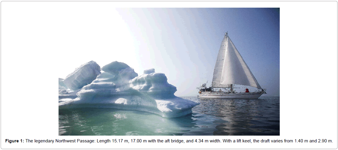
Best Explorer is a cutter steel S/Y of the following dimensions: Length 15.17 m and 17.00 m. with the aft bridge, and 4.34 m width. With a lift keel, the draft varies from 1.40 m and 2.90 m. It has a 95 HP Solé Diesel Engine. The sail area is 181 m². Best Explorer is ranked 100 A 1.1 by RINA. It displaces about 25 tons. The lift keel allows the approach and navigation on shallow waters, which are found frequently in the north. The bow has been reinforced and is in stainless steel with a thickness of 6 mm against the 5 mm of the rest of the hull (Figure 1).
Discovered between 1903 and 1906 by the Norwegian Roald Amundsen, who spent a long time studying - among other things - terrestrial magnetism, the Northwest Passage is that maritime itinerary that links the Atlantic Ocean to the Pacific Ocean passing through the maze of islands and ice of the Canadian Arctic Archipelago (Nunavut), which extends well above the Arctic Circle.
Best Explorer left Tromsø – in northern Norway – on the 1st of June 2012 and ended its trip to King Cove – on the southern coast of the Alaskan peninsula – on the 14th of October same year, after 140 days of navigation and a measured distance on the sea of 8.181 nautical miles (about 15.000 km), touching the maximum latitude of 74° 30' North (less than 1.700 km from the North Pole) in Dundas Harbor on the southern coast of Devon Island.
Difficulties were not lacking in its pilgrimage. From an instrumental point of view, the proximity of the magnetic north pole has rendered the compass unusable for all the central part of the journey (from the Davis Strait to Gjøa Haven on the King William Island) and the lack of GPS signal, guaranteed up to the latitude of 70° North, it has further complicated things; in addition, the cartography has not been of great support fundamentally because there is not (fortunately) still a commercial interest in those areas of the planet, nobody cares about detecting the depth of the waters and coastlines with the necessary accuracy.
Literature Review
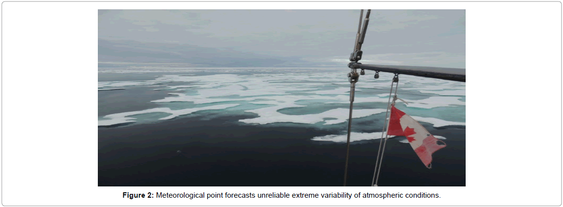
From the meteorological point of view, the forecasts were found to be somewhat unreliable due to the extreme variability of atmospheric conditions and, once again, to the scarce commercial interest; the melting of ice that occurs from year to year with different effects does not simplify navigation because, due to the currents and winds, the huge pack slabs wander unpredictably and clog the narrow passages between an island and the other. We have had the opportunity to experience the distressing experience of getting stuck in ice on several occasions, sometimes only for a few hours, sometimes for several consecutive days (Figure 2).
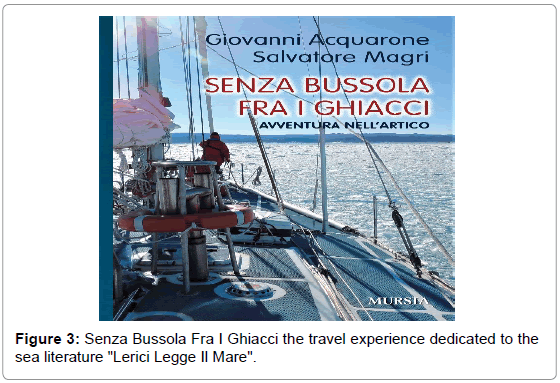
The whole travel experience, already told by the media, is now transcribed in the book "Senza Bussola Fra I Ghiacci", published by Mursia-Italy, presented in preview at the event dedicated to the sea literature "Lerici Legge Il Mare", Lerici (SP) Italy, on the 10th of September 2017 [2] (Figure 3).
From 2012 to date, Best Explorer has not stopped and sailed along the southern coasts of Alaska, western Canada, the United States, Mexico and Baja California, the Galapagos, Polynesia, Rarotonga, Tonga, Fiji, Vanuatu, New Caledonia, Australia and its coral reef, and finish on August 2017 in Sorong in West Papua (Indonesia). In 2018, then, Best Explorer sailed from Indonesia to the Philippines and Japan, touching the major towns to promote the "made in Italy", in collaboration with the Italian chambers of commerce.
Always, Best Explorer is not only driven by the spirit of sporting competition but also by the cultural and scientific aims of which it has often promoted or acted as a spokesperson, especially during those navigations in parts of the globe that are still poorly visited. Now Best Explorer is about to make another extraordinary feat to return to Europe. And it will do it by overcoming itself.
In Japan, Best Explorer will spend time on the final set-up stage before launching northward in early summer 2019 and being near the Bering Strait by the end of July. From there, with the entrepreneurial spirit that sets it apart, it will once again face the Arctic Ocean ices in northern Siberia, where very few S/Y have succeeded in the enterprise, trying to reach Tromsø in Norway, the place from which the adventure had begun on 2012. If the climatic conditions and the administrative permits allow it, a passage will be made to Svalbard to visit the Italian scientific station.
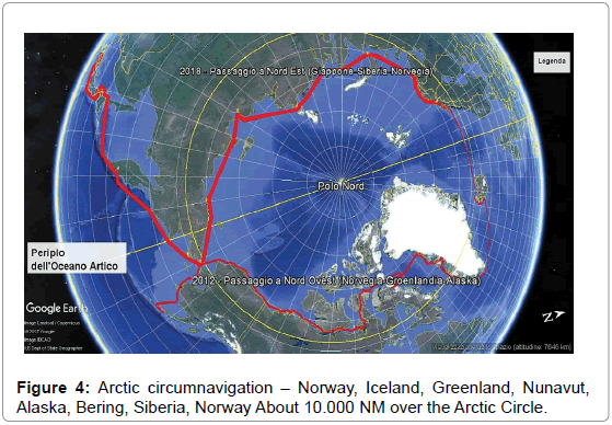
This itinerary called Northern Arctic Sea Route (or Northeast Passage) of about 8,400 miles, with an expected duration of 4-5 months, will allow Best Explorer - and the Italian flag - to complete the world tour and, at the same time, boast of the title of the first Italian boat to complete the entire journey of the Arctic Ocean (Norway To Norway). Leaving Japan, some locations have been identified along the route where stops will be made for meetings on land and for supplies, while crew members will not be replaced unless for emergency reasons. In the order from east to west: Petropavlovsk in Kamchatka, Provideniya or Anadir in the Bering region, Pevek, Tiksi, Cape Chelyuskin in Siberia, Lands of Francis Joseph and Murmansk in the Cola peninsula (alternatively Svalbard) (Figure 4).
Discussion
Once this second Arctic expedition has been completed, joining the Northwest and the Northeast Passages, Best Explorer will have sailed for about 10,000 nautical miles (more than 18,000 km) among the ice, beyond the Arctic Circle. Some 5,000 nautical miles more, to be sailed in the next years, will bring Best Explorer into the Mediterranean and back home towards the Italian shores. The greatest difficulties of this new Expedition compared to the Northwest Passage are determined by the higher latitude of 80° North and by at least three important factors.
The first factor concerns the navigation support instrumentation. Regarding the satellite geopositioning signals, the GPS signal is certified up to 70-72° North. It would be interesting to test other GNSSs such as the Galileo system, operating since December 2016 [3], the Japanese QZSS system, the Russian GLONASS system and the signals of SBAS (Satellite Based Augmentation Systems) such as EGNOS. Other satellite communications are also in "off-limits" conditions in the Arctic areas. Geostationary systems are seen with difficulty due to the (almost) horizontal antenna pointing. Even when it was possible to create a connection, this can be subject to interruptions caused by the ice on the antennas or rough seas. Polar systems, such as IRIDIUM and GLOBASTAR can provide useful coverages at those latitudes. However, there have been cases of service interruptions that can last several minutes, sometimes hours. Unfortunately, as far as we know, systems such as IRIDIUM do not provide broadband communication.
The second factor concerns the presence of ice that persists in many areas of the Passage, certainly at Cape Chelyuskin. Support to know in advance the sea ice coverage (iceberg) would be very useful. In this, satellite observation of the Earth could help very much. An interesting system is Cosmo-Skymed. Furthermore, satellite Earth observation systems can be useful for estimating coastal bathymetry, although in Arctic areas it is constantly changing due to the ice.
The third factor concerns the scarcity of anchorages or landings points to refill of food, water and fuel supplies and possible emergency crew changes. As in the previous expeditions, this year it will bring the Italian cultural message to the local communities. But - above all - it will be an inexhaustible source of scientific data on terrestrial magnetism, on the functioning of satellite tracking systems, on short-wave radio communications, as well as on observations about the conservation status of ice and that delicate environmental balance able to influence the presence of animal species and the climate on the entire planet. It is in this direction that goes the collaboration agreement reached with ENEA who will install a marine fluorometer on board Best Explorer. The information collected by the seawater samples will be used to recalibrate the satellite data. The same will be done with samples in search of microplastics in collaboration with a team of researchers from two prestigious Italian Universities: University of Tuscan and University of Siena. This study will provide a trace of how microplastics, produced in countries at lower latitudes, are dragged up into the Arctic by currents and winds [4]. The GNSS satellite navigation services, including those of the Galileo constellation could be very helpful in Arctic navigation such as the one Best Explorer is about to face [5,6].
Conclusion
Best Explorer would provide a significant opportunity to test the satellite services in such "critical" geographic areas. Therefore, Best Explorer is open to proposals for scientific and cultural projects by companies and public and private institutions, as long as they are compatible with the space available on the boat and navigation in a hostile environment. Of fundamental importance and a source of pride for Arctic Sail Expeditions - Italy is the granting of patronage by some Ministries, including that of the environment. Lastly, as the costs to be faced are significant the crew can no longer support all of them, so he is looking for sponsors who can support the expedition in the Northeast Passage economically and/or with specific supplies.
Funding
https://www.nordovestitalia.org/en-contribution
References
- Giovanni A (2010) Best explorer - Dal Mar Ligure al Mare Glaciale Artico. Ed: Il Frangente p. 272.
- Giovanni A, Salvatore M (2017) Senza bussola fra i ghiacci. Ed: Ugo Mursia, Brossura, p. 392.
- Reid T, Walter T, Blanch J, Per E (2016) GNSS Integrity in the arctic. Navigation. J Inst Navig 63: pp. 467-490.
- Reid T, Walter T, Per E (2014) Crowdsourcing arctic navigation using multispectral ice classification & GNSS. Proceedings of the 27th International Technical Meeting of the Satellite Division of The Institute of Navigation (ION GNSS+ 2014). Tampa, Florida; pp. 707-721.
- Østreng W, Eger KM, Fløistad B, Jørgensen-Dahl A, Lothe L, et al. (2013) Shipping in arctic waters-A comparison of the Northeast, Northwest and Trans Polar Passages. Springer, UK.
- Birkeland R (2014) An overview of existing and future satellite systems for arctic communication. The 4S Symposium.
Citation: Acquarone G, Magri S, Caporale M (2019) Northern Arctic Sea Route (North East Passage) on Best Explorer. J Earth Sci Clim Change 10: 517.
Copyright: © 2019 Acquarone G, et al. This is an open-access article distributed under the terms of the Creative Commons Attribution License, which permits unrestricted use, distribution, and reproduction in any medium, provided the original author and source are credited.
Share This Article
Recommended Journals
Open Access Journals
Article Usage
- Total views: 2841
- [From(publication date): 0-2019 - Feb 19, 2025]
- Breakdown by view type
- HTML page views: 2204
- PDF downloads: 637


